Welcome to the Magic Valley!
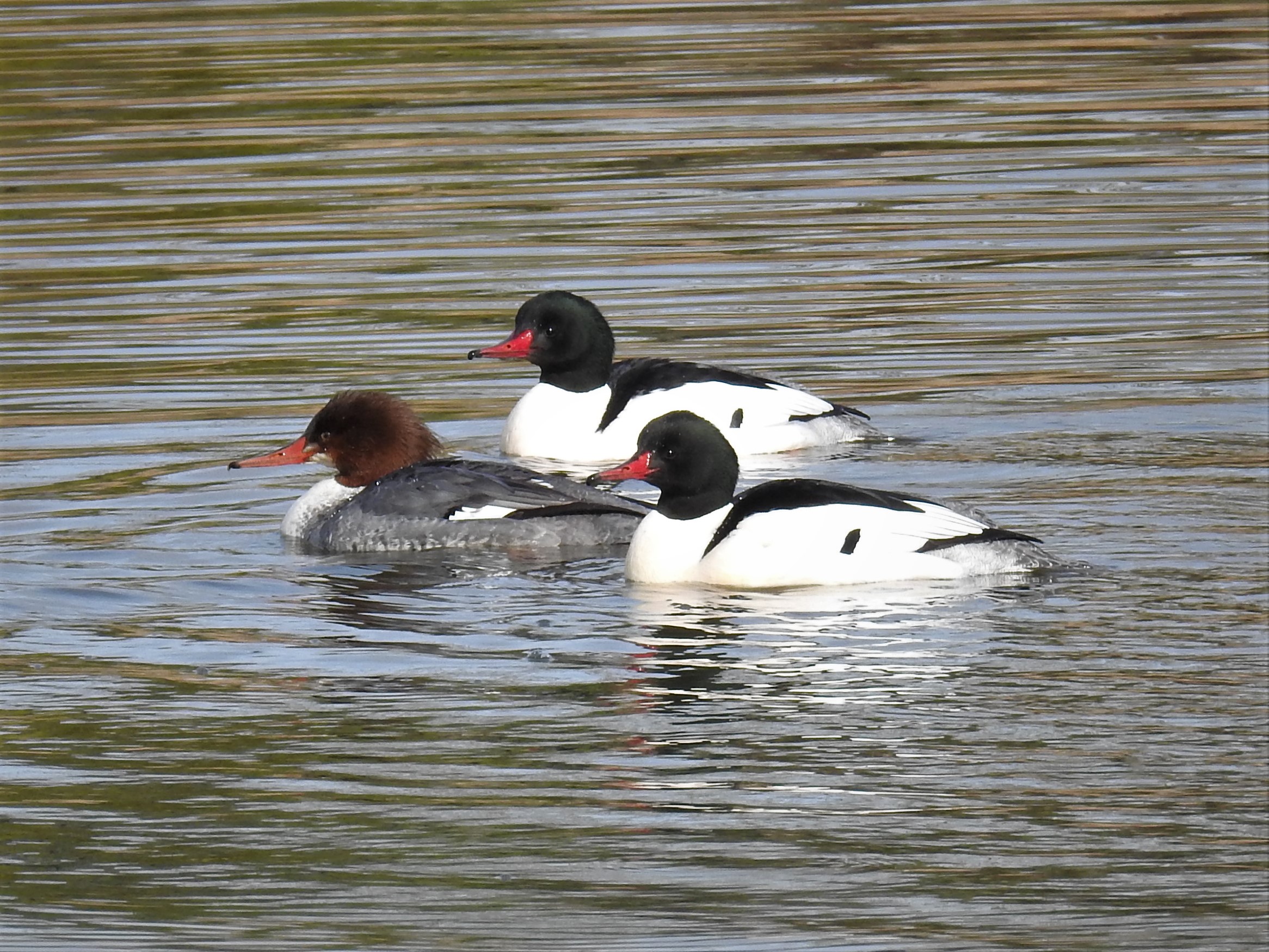
Twin Falls and the surrounding area boast many beautiful natural areas teeming with interesting bird life. Whether you have an afternoon or several days this guide can help you focus in on the most interesting birding hotspots. Area specialties include Rock Wren, Greater Sage Grouse, American Dipper, Lewis Woodpecker, Say’s Phoebe, Bushtit, Juniper Titmouse, Cassia Crossbill, Flammulated Owl, Ferruginous Hawk, Northern Goshawk, Prairie Falcon, and Golden Eagle.
Centennial Park
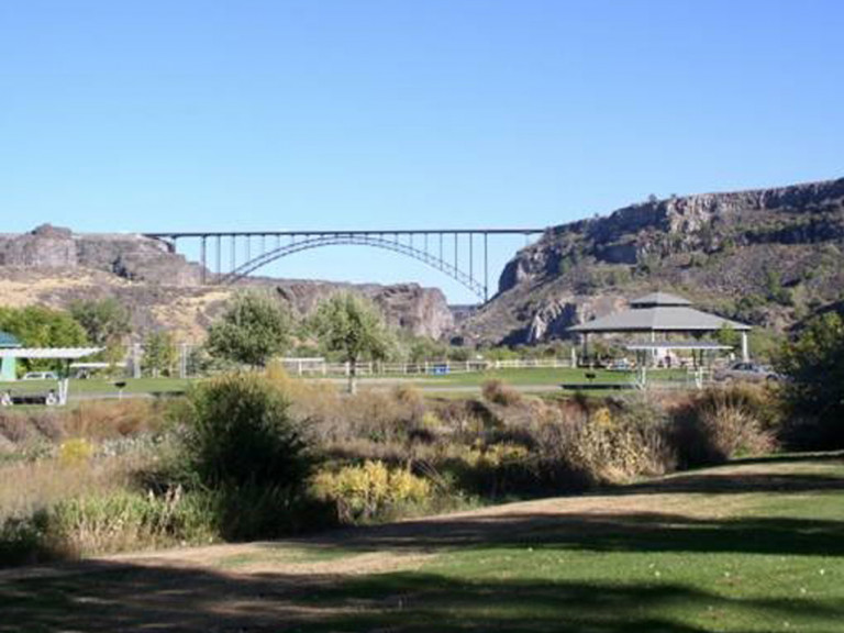
Description: City park below the Perrine Bridge along the Snake River. Willow riparian areas, towering basalt cliffs, slow moving open water, sagebrush/grassland/shrub areas.
Birds: American White Pelican, Great-blue Heron, Black-crowned Night Heron, Double-crested Cormorant, Lazuli Bunting, Bullock’s Oriole, Western Tanager, Spotted Towhee, White-throated Swift, Golden Eagle, White-Crowned Sparrow, Song Sparrow, Canyon Wren, Red-tailed Hawk, Bald Eagle, Townsend’s Solitaire.
Directions: From the Perrine Bridge head south. Turn right onto Canyon Springs Road. Look for the sign to Centennial Park near the bottom of the canyon.
Dierkes Lake/Shoshone Falls Park
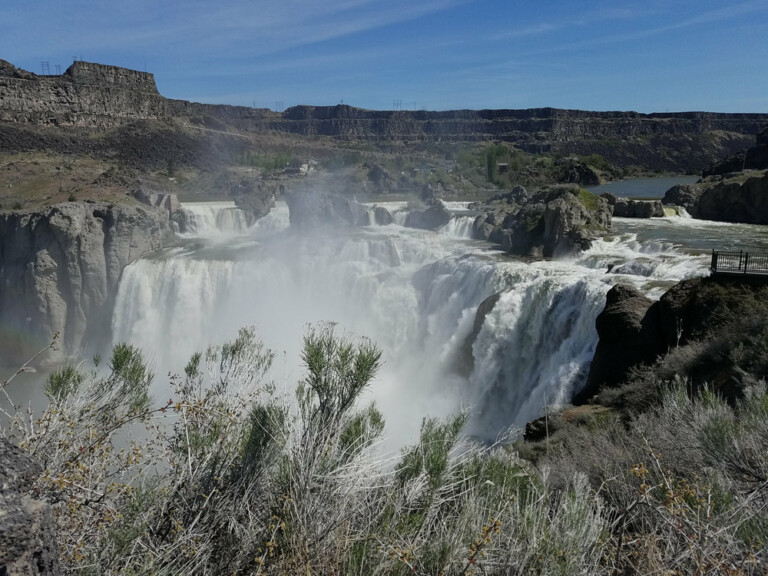
Description: A county park six miles from the Perrine Bridge. Large deciduous trees in park areas, basalt/rhyolite cliffs, cattail/reed marshes, open water, sagebrush/grassland.
Birds: Rock, Marsh and Canyon Wren, Sora and Virginia Rail, Golden Eagle, American Dipper (near Shoshone Falls), Bullock’s Oriole, Western Tanager, Brown Creeper, Violet-green and Cliff Swallows.
Directions: From the Perrine Bridge head south on Blue Lakes Boulevard one mile. Turn left onto Falls Avenue. Turn left after three miles at the sign for Shoshone Falls Park. After descending into the canyon stay left for Shoshone Falls Park or turn right at the sign for Dierke’s Lake Park. A small admission fee is charged during summer.
South Hills/Magic Mountain/
Rock Creek Road
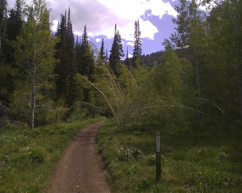
Description: Exquisite high desert canyon drive with plenty of hiking available. Fabulous birding spring through fall. Habitat: Sagebrush steppe, willow, cottonwood, aspen, riparian, mountain mahogany and subalpine fir groves within a deep rhyolite canyon.
Birds: All three accipiters, Prairie Falcon, Kestrel, Golden Eagle, Chukar, Lewis Woodpecker, Red-naped sapsucker, Calliope, Rufous, Black-chinned and Broad-tailed Hummingbirds, Swainson’s and Hermit Thrush, Western Wood Pewee, Lark, Fox, Song, Brewers, Vesper, and White-Crowned Sparrow, Lazuli Bunting, Juniper Titmouse, Warbling and Plumbeous Vireo, MacGillivray’s, Yellow, Yellow-rumped, Wilson’s, and Black-throated Gray Warbler, Northern Pygmy, Flammulated, Northern Saw-whet, Western Screech-owl, and Great-horned Owls (with tapes), Hammonds, Dusky and Cordilleran Flycatchers, Mountain Bluebird, Common Poorwill and many more. Of special interest is the Cassia Crossbill, recently recognized to warrant species status by the American Ornithological Society, giving Idaho its sole endemic species.
Directions: From the Perrine Bridge head south for 4.5 miles on Blue Lakes Boulevard. Turn left on 3700 North (also called Orchard and Sugar Factory Road). Pass through Kimberly at five miles and when you reach Hansen (eight miles from Blue Lakes Boulevard) turn right on Rock Creek road at the sign for Sawtooth National Forest. Continue eight miles south to the mouth of Rock Creek Canyon and then as many as 18 more miles to the top at Magic Mountain Ski Area. In summer (and if you have a map) continue west on the Rogerson Road through the Shoshone Basin to make a loop finishing up on U.S. 93.
CSI Campus/CSI Wetlands
Description: Landscaped college campus with mature trees, large semi-wild constructed wetland.
Birds: Song Sparrow, White-crowned Sparrow, Marsh Wren, Red-winged and Yellow-headed Blackbird, Common Snipe, Great-horned Owl, Red-tailed Hawk, Red-breasted Nuthatch, Brown Creeper, Northern Flicker.
Directions: From the Perrine Bridge head south on Blue Lakes Boulevard. After one mile turn right onto North College Road. In ½ mile the College of Southern Idaho Campus is on the left with ample parking and the Breckinridge Wetland on the right.
Hagerman Wildlife Management Area
Description: Wonderful habitat including large expanses of marsh, wetland, and open water, riparian area, mixed scrub/conifer/deciduous habitat.
Birds: Over 100,000 ducks winter here including the Greater Scaup, Northern Pintail, and Wood duck. Bald Eagle, Northern Harrier, Prairie Falcon, Accipiters, Barn and Great-horned Owl, Virginia Rail and Sora, Trumpeter and Tundra Swan, Black-crowned Night Heron, Ruby-crowned Kinglet, Warbling and Plumbeous Vireo, Brown Creeper, American Pipit, Common Yellowthroat, Yellow- breasted Chat and many others. The Hagerman Christmas Bird Count often has the high number for species in Idaho and also has potential for many rarities.
Directions: Head north from the Perrine Bridge on US 93, exiting onto I- 84 heading west, at exit 155 (just past Wendell) take exit 155 onto the Hagerman Highway (E 2950 S) and head west towards Hagerman. In about nine miles turn left onto US 30, turn left between mileposts 184 and 183 onto State Fish Hatchery Road at which point you will be on the refuge.
Google Map
Rock Creek Park
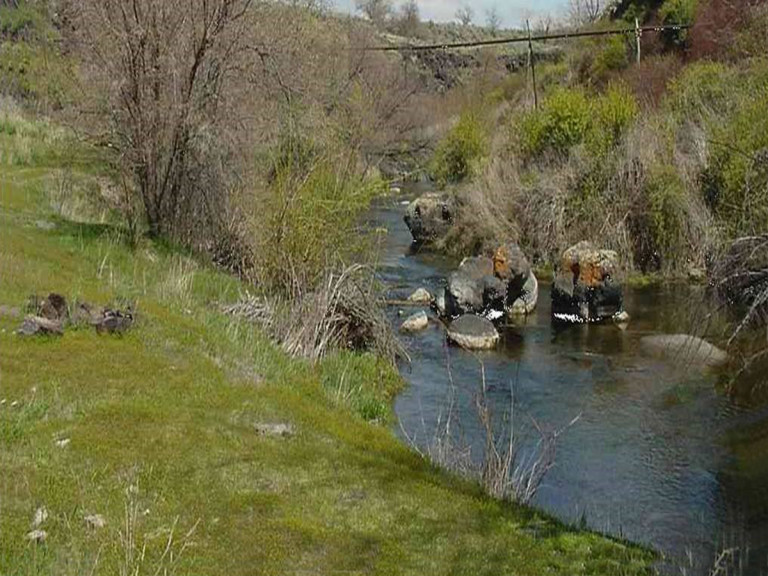
Description: County Park and Greenbelt, small basalt canyon, Russian olive creek side/riparian habitat.
Birds: Sharp-shinned and Cooper’s Hawk, Merlin, Cedar and Bohemian Waxwings, House, Rock, and Canyon Wren, Yellow and Yellow-rumped warblers, Common Snipe, Black-capped and Mountain Chickadee, Great- horned, Western Screech-owl, and Saw-whet Owls, American Goldfinch, Pine Siskin, numerous American Robins and the beautiful Black-billed Magpie.
Directions: From the Perrine Bridge head south on Blue Lakes Boulevard. At about 2.5 miles turn right onto Addison Avenue (Highway 30 & 93). In about two miles (after crossing Rock Creek Canyon) watch closely for the sign to Rock Creek Park on the right.
Murtaugh Lake
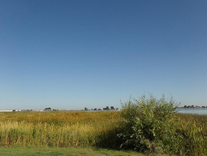
Description: Small Reservoir, marsh, and grassy park area.
Birds: Marsh Wren, Virginia Rail, Common Snipe, American Kestrel, White-faced Ibis, Caspian, Forester’s and Black Tern, American White Pelican, Yellow-headed Blackbird, Common Yellow-throat, Violet-green, Tree, Northern Rough-winged and Barn Swallow, and numerous ducks in the winter.
Directions: From the Perrine Bridge head south for 4.5 miles on Blue Lakes Boulevard. Turn left on 3700 North (also called Orchard and Sugar Factory Road). Pass through the town of Kimberly at 5 miles. At Hansen (3 more miles) 3700 North becomes US 30. Continue 8 miles to the Sportsman’s Access sign and turn right.
Thousand Springs State Park
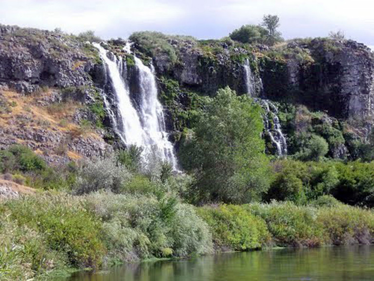
Description: Nestled alongside the picturesque Snake River, between two magnificent springs, the property includes waterfalls, transparent springs, marshland, large deciduous trees, and sagebrush/juniper scrub with basalt outcroppings.
Birds: American Dipper, Great and Snowy Egret, Barn/Great-horned/Western Screech-owl, Great-blue and Black-crowned Heron, Sora and Virginia Rail, Lazuli Bunting, Yellow-breasted Chat, Wood Duck, accipiters, Prairie Falcon, Golden Eagle.
Directions: Go north from the Perrine Bridge to I-84 and go west. Take exit 155 and follow Hagerman Highway west. After 3.5 miles turn left on 1500 E and go 2.5 miles. Turn right on 3200 S and drive 2 miles to the “T” intersection. Turn left on 1300 E for 0.2 mile, then right on Thousand Springs Grade which descends into the canyon.
Camas Prairie Centennial Marsh WMA
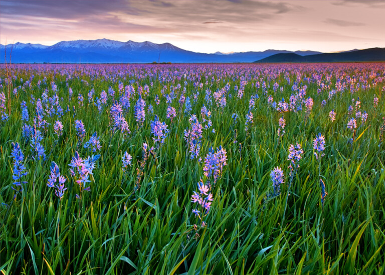
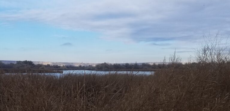
Description: 3,000-acre wetland famous for intense Camas blooms in late May. Brush/sedge/ camas marsh surrounded by high desert sagebrush steppe and farmland.
Birds: Sora, Black-necked Stilt, American Avocet, Wilson’s Phalarope, Sandhill Crane, Long-billed Curlew, Eared Grebe, Prairie Falcon, Sage Thrasher, Mountain Bluebird, Brewers’ and Vesper Sparrow.
Directions: From the Perrine Bridge head north and take I-84 west. Exit at Wendell (exit 157) onto Highway 46. Drive through Wendell and Gooding through the Bennett Hills and down into the Camas Prairie. Turn left onto US 20 through Fairfield to milepost 143.1. Turn left (south) onto Wolf Lane. After 5 miles turn right onto Stokes Road which will take you to the Wildlife Management Area.
Other Good Birding Areas
- Balanced Rock State Park
- Niagara Springs Wildlife Management Area
- Malad Gorge State Park
- Box Canyon State Park
- Billingsley Creek State Park
- Cottonwood Creek Special Management Area
- Lake Walcott/Minidoka Wildlife Refuge
- Milner Dam Recreation Area
- Shoshone Basin
- Jarbidge Resource Management Area
- Silver Creek Preserve
- Hummingbird Feeding Area